History of the Region
Nestled in the South West region of Western Australia, the Waroona area has a rich and diverse history shaped by both its natural environment and the people who have called it home. Originally inhabited by the Bindjareb people of the Noongar Nation, the region is steeped in Aboriginal culture and connection to the land. European settlement began in the 1800s, spurred by the establishment of the South Western Railway and the growth of timber milling and agriculture. Over time, the region has evolved into a vibrant rural communities known for its farming, dairy production, and strong community spirit, with many historic buildings and sites still reflecting its past today.
Waroona
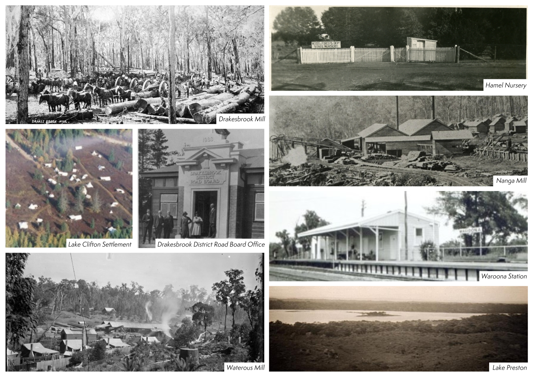
Situated in the foothills of the Darling Scarp, the town of Waroona boasts a rich and diverse local history. British exploration and settlement began in the 1830s, with small communities gradually forming along the coast and in nearby forested areas. In 1893, a railway station was established along the Pinjarra to Picton Junction line and was named ‘Drakes Brook’ after W.H. Drake, an early landowner in the region. The surrounding townsite was officially gazetted as Drakesbrook in 1895. At the northern end of the townsite, Joseph McDowell built a timber mill, and a railway siding was opened. A new subdivision was surveyed and became known as Waroona. McDowell’s railway siding was later converted to Waroona Station. The two settlements gradually merged into one town before officially being named as Waroona in 1946.
The town quickly developed to support its growing population of mill workers, featuring amenities such as a post office, general store, blacksmith, several hotels and boarding houses, churches, as well as medical services including a doctor and dentist. Local farms supplied fresh produce to mill workers and provided chaff for the horse teams that hauled timber. Dairy farming also emerged as a key industry, with farmers producing milk, butter, and cheese. Today, the Waroona area is still a large agricultural producer, along with engineering, earthmoving, and mining.
Like many rural towns, Waroona thrived on community spirit, with dances, picnics, and football at the heart of social life. That legacy continues today, with Waroona maintaining a strong sporting culture and vibrant community atmosphere with many social events and activities.
Hamel
Located just 3 km south of Waroona, Hamel was officially gazetted as a townsite in 1899. It was named in honour of Mr. Lancal V. de Hamel, the original landowner of the area.
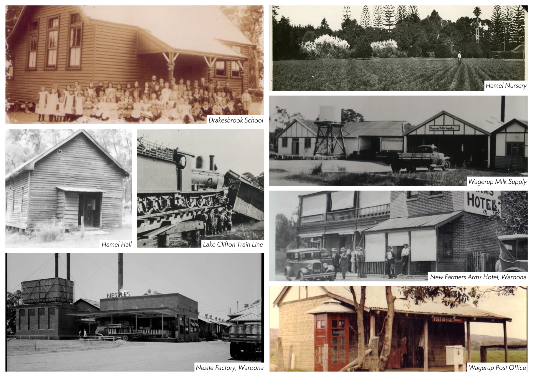
In 1897, the Western Australian Government established a State Nursery in Hamel. This nursery supplied plants to a range of notable locations including Kings Park, Perth Zoo, Rottnest Island, Hyde Park, Harold Boas Gardens, and others. Although the nursery was relocated to Coolup in 2007, the original site now serves as the Hamel Eco Park.
In 1902, a prison work camp was established in Hamel, constructed by the prisoners themselves. It was the first outstation set up under Fremantle Prison, designed for short-term and soon-to-be-released inmates, who worked in the nursery as part of their rehabilitation. The prison closed in 1907 and in 1919, one of the main buildings was relocated in a single piece and is now known as the Hamel Hall. The remaining prison structures were demolished.
As it is today, the area was primarily used for farming and agriculture with rich soils and good irrigation. A school operated from 1905 to 1944, a post office from 1965 to 1987, and the Hamel store from 1949 to the 1980s. Today, residents use services at nearby Waroona.
Wagerup
The Wagerup area was once home to three former townsites: Wagerup, Yalup Brook, and Waterous.
Waterous Mill, one of the earliest timber mills established in the ranges east of the South West Railway, was completed in 1897. The surrounding townsite of Waterous was officially gazetted in 1907. However, the mill ceased operations by the end of 1909, prompting most workers to relocate—many moving to the nearby settlement of Old Hoffman.
The Wagerup townsite, located about 12 kilometres south of Waroona, was gazetted in 1899. It took its name from the nearby railway station and Wagerup Brook. The brook was first recorded as "Waigeerup" by a surveyor in 1853—a spelling that was also used when the railway station opened in 1896. By 1899, however, the spelling had changed to "Wagerup," reportedly due to a sign painter’s misspelling at the station, which then became the accepted version.
To the north of Wagerup, Yalup Brook was gazetted in 1912 following the establishment of a rail siding in 1897. Due to its proximity to Wagerup, the town saw limited development. In 1926, the Yalup Brook post office and railway facilities were merged with those of Wagerup. A new post office was built in 1944 and served the area until 1977, when the Wagerup townsite was officially dissolved and its residents became part of the Yarloop district.
Originally an agricultural region, Wagerup entered a new industrial era in 1984 when Alcoa of Australia began operations at their Wagerup Alumina Refinery.
Nanga Brook
Situated east of Waroona in the Darling Scarp, the area was once home to a thriving milling town that operated from around 1900 until the devastating bushfires of 1961. Timber harvesting began as early as 1898, and in 1902, a lease was granted to the Millars Karri & Jarrah Company of Yarloop (formerly Millar Brothers). For many years, the Nanga Mill was the largest in the region, at times employing more than 100 men.
In 1909, Millars established a townsite to support the mill, constructing 56 houses along with lodgings, a general store, butcher, hall, billiard room, and school. The town later expanded to include three tennis courts and a sports oval.
After the original mill was destroyed by fire in 1941, a smaller mill was built, requiring just 16 workers. By then, Nanga Brook was already facing difficulties, struggling to compete with the more modern Dwellingup mill. The catastrophic fires of January and February 1961 completely destroyed the town, and in 1962, the Governor-General officially declared its closure.
Following the fires, the area was reforested with pine by the Forests Department (now the Department of Parks and Wildlife), which began promoting it as a site for camping and picnicking. Today, the area forms part of the 55,000-hectare Lane Poole Reserve and remains a popular destination for bushwalking and outdoor recreation.
Lake Clifton
Lake Clifton is a town located on the Old Coast Road, approximately 27 km from Waroona and 38 km south of Mandurah. Situated beside the lake that shares its name, the town spans two local government areas. It was originally established in 1921 as a bustling company town to support the lime deposit mining operations of the WA Portland Cement Company.
In 1920, a railway was constructed from Waroona to Lake Clifton to transport lime to the cement works in Burswood via Waroona. Initially gazetted as 'Leschenault' in 1921, the townsite was later renamed 'Garbanup' in the same year, before being officially changed to 'Lake Clifton' in 1923. That same year, the mine closed, and the railway ceased operations in 1924. Parts of the railway were later repurposed for constructing the Lake Grace–Newdegate line.
Today, remnants of the old railway can still be found, along with the brick remains of the rotary kiln, which can be seen along the Lime Kiln Walk Trail.
Click on the link below to watch a short video on the history of the walk trail.
Lake Clifton Lime Kiln - Video
Preston Beach
Preston Beach is a coastal town located 38 km west of Waroona. Originally developed in 1959 as the "Preston Beach Estate," it was later joined by the "Lakeside Estate" and collectively designated as the locality of Yalgorup—a Noongar word meaning "place of waters or lakes"—at the request of the local government. The townsite was officially gazetted in 1975. In 1989, the name was changed to Preston Beach, reflecting the name commonly used by the local community, following a request from the Shire of Waroona.
The area today is known for its great fishing, 4wd beach access and scenic beauty. It is a small, but active community of permanent residents, retirees and holiday makers.
Waroona Historical Society
The Waroona Historical Society operates from the old Drakesbrook District Road Board Office on the corner of Millar Street and South Western Highway. They are the caretakers of a valuable collection of memorabilia and historical information of the Waroona region. The Museum is open from 10am until 12 noon on Sundays, or by appointment and is well worth the visit to find out more about the Shire's history. Phone 0417 705 966, email waroonahistsoc@gmail.com, or visit their website at https://waroonahistoricalsociety.wordpress.com/